
British Army tests GPS-denied navigation outcomes
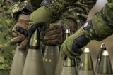
One of the scenarios during November's AWE was GPS-denied navigation in a basement. (Photo: Rafael)
British Army troops have concluded testing with Rafael's FOOTPRINT navigation system for ground forces.


As part of the Army Warfighting Experiment (AWE) at HM Naval Base Portsmouth, ground troops of the British Army conducted a set of trials in November with the Rafael FOOTPRINT system in a number of urban scenarios. The system allows soldiers to navigate and self-position in GPS-denied environments.
Under the auspices of the Defence Science and Technology Laboratory (dstl and Future Capability Group, soldiers tested the FOOTPRINT system between and inside buildings and into basements as well as in open areas.
FOOTPRINT was connected to CivTAK (Civilian Team Awareness Kit, a derivative of the ATAK terminal) which allows soldiers to stand in a variety of sites and conduct operational tasks whilst activated.
Commanders were able to obtain an accurate picture of the location of each solider with an understanding of the operational situation, according to Rafael.
Shmuel Olansky, head of the Multi-Domain Warfare Directorate at Rafael said: 'FOOTPRINT will allow higher command to better direct its troops and help prevent cases of friendly fire in a complex space. We thank the British Army for hosting our delegation and demonstrating our system's practical applications.'
The November iteration of AWE, Sustain & Protect, will be followed by AWE Shape & Defend in 2023 and AWE Urban Integrate in 2024.
Rafael increased its presence in the UK defence market by acquiring mobility specialist Pearson Engineering in September.


More from Digital Battlespace
-
![World Defense Show 2026: Northrop Grumman to present improved C2 management system]()
World Defense Show 2026: Northrop Grumman to present improved C2 management system
The Northrop Grumman Integrated Battle Command System is in service with Poland and the US Army with another 20 countries believed to have expressed an interest.
-
![Thales looks to boost DigitalCrew system through AI and human-machine teaming trials]()
Thales looks to boost DigitalCrew system through AI and human-machine teaming trials
The Thales DigitalCrew package, first unveiled at last year’s Defence IQ International Armoured Vehicles conference, is designed to merge imaging and apply a layer of decision-making and observation algorithms to support crew and other personnel.
-
![Babcock nears first customer for Nomad AI translation tool]()
Babcock nears first customer for Nomad AI translation tool
Nomad can provide militaries with real-time intelligence, saving critical time on the battlefield.
-
![AUSA 2025: Israel’s Asio Technologies to supply hundreds of improved Taurus tactical systems]()
AUSA 2025: Israel’s Asio Technologies to supply hundreds of improved Taurus tactical systems
Taurus operates alongside the Israel Defense Forces’ Orion system which supports mission management across tens of thousands of manoeuvring forces, from squad leaders to battalion commanders.
-
![AUSA 2025: Kopin pushes micro-LED plans as China moves faster]()
AUSA 2025: Kopin pushes micro-LED plans as China moves faster
The plan for the new displays follows fresh investment in Kopin’s European facilities by Theon and an order for head-up displays in fielded aircraft, with funding from the US Department of Defense.
-
![AUSA 2025: Persistent Systems to complete its largest order by year’s end]()
AUSA 2025: Persistent Systems to complete its largest order by year’s end
Persistent Systems received its largest ever single order for its MPU5 devices and other systems earlier this month and has already delivered the 50 units to the US Army’s 4th Infantry Division.


