The best sensor simulation around? (sponsored)


This article is brought to you by Presagis.
Sensor vision is one of the most important advantages on today’s battlefield.
It allows warfighters and intelligence collectors to see further and better than the enemy does – especially in reduced or remote visual environments. Sensor training – or instrumentation enablers – has become an essential component of today’s simulation requirements – both on and above the battlefield.
For nearly 30 years, Presagis has specialized in the 3D aerial sensor simulation of terrain using Electro-optical, RADAR, Infrared, and LiDAR sensor signals. Their company has developed material classification workflows and material encoding techniques to support the physics-based modeling of wave frequency propagation, reflections, and diffraction. As an industry leader, the range and quantity of Presagis software products throughout the DoD and aerospace OEM community is substantial.
Presagis has been steadily developing and releasing what many consider the highest quality sensor simulation software in the industry, the Ondulus suite of products provide the realism needed for research and design, as well as the accuracy and immersion required for mission training in a Common Operating Environment.
The Ondulus Suite is comprised of four distinct, standalone applications: IR, LiDAR, NVG, LLLTV, and Radar. Each one is part of an end-to-end modeling and simulation framework that includes database & 3D modeling tools, native OGC CDB support, terrain material classification tools, computer-generated forces, flight dynamics and modelling. All of these applications (except Radar) can be integrated into game engine technology, such as Unreal Engine.
Finally, with regard to export and usage overseas, many of the sensors are based on academic models. In addition, all Ondulus products are developed in Canada, and can be integrated in any existing solution or framework. With wide export capabilities, Ondulus can be deployed and supported almost anywhere in the world.
Infrared
From sensor training and R&D, to hardware-in-the-loop and weapon simulation, the ways in which infrared simulation is being used on and off the battlefield is growing rapidly.
Ondulus IR gives simulations and training scenarios a critical component: physics-based infrared sensors. Capable of simulating short, medium, and long wavelength infrared views, Ondulus IR is fully configurable. Ondulus IR simulates Thermal and Photon detectors, and, as such, is equipped to dynamically calculate light reflections, thermal radiation, loading, cooling, as well as conduction and convection.
Computation is available for any time of day (diurnal effects), any time of year, under any atmospheric conditions, at any location on the planet, and also takes into account the energy exchanged between the sun and different materials. Ondulus IR can reduce costly integration time and streamline the development process by being mounted on virtual vehicles, ships, aircraft, helicopters, or UAVs.
Built on a modular, open architecture, simulation developers can easily replace default models with their own or even write their own physics using GPU shaders. Ondulus IR was designed with computational performance in mind – this translates to higher-density scenes and wider field of view than any other solution on the market.
LiDAR
Simulating scanner or direct laser beam (in the visible spectrum or not), Ondulus LiDAR was designed to generate a high-quality point clouds that closely resemble the point clouds produced by real LiDAR sensors in terms of density of points as well as their position and intensity.
Ondulus LiDAR’s laser reflection model accurately interacts with materials and face orientations. Employing physics-based rendering, the LiDAR sensor captures accurate physical information such as material’s “bounced” energy. LiDAR returns are geo-referenced and use accurate GPS and IMU information.
Out of the box, Ondulus LiDAR is equipped with an LCM-based communication library, which simulates the Opal2 data model (Neptec).
Nightvision & LLLTV
Ondulus NVG (night vision goggles) and LLLLTV (Low Light Level Television) provides night vision and low light level views of a dynamic scene containing detailed terrain, building and water materials, as well as, moving platforms and characters.
Inspired by physics-based rendering – meaning that a scene’s lighting is re-calculated based on light sources as well as materials – Ondulus NVG allows complete control. From light amplification and blooming, to vignetting, and secondary reflections, users have complete control over realism and accuracy.
Ondulus NVG supports both passive and active illumination sources. Active illumination can be sourced from any (external) location, i.e.: helicopter-mounted.
Radar
The benefit of radar simulation is that it is highly flexible, allowing tuning of radar returns and the replication of specific effects. Ondulus Radar delivers the ability to add high-fidelity, high-performance, physics-based radar sensor simulation into a wide variety of applications. Moreover, users have immense control on the types, modes, and parameter configurations.
In a research or testing environment, this permits a greater understanding of how visibility, distance, mobility and speed affects your applications.
Ondulus Radar lets users control and simulate:
- Ground-based radar
- Onboard radar (vehicle or aircraft)
- Radar antenna
- Wavelength
- Look angle
- Polarization
- Jammers
- Range Gate Stealer
- False Target Generator
- Power / Resolution / Rates
- Pattern / Band / Frequency
- And much more…
Ondulus Radar supports the following radar modes:
| Group | Modes Included |
| Base | RBGM: Real Beam Ground Map Wx: Weather DBS: Doppler Beam Sharpening |
| Searching | MTI: Moving Target Identification GMTI: Ground Moving Target Indication (supported in RBGM and Spot SAR) RWS: Range While Scan |
| Tracking | TWS: Track While Scan STT: Single Target Track |
| SAR | iSAR: Inverse Synthetic Aperture Radar SpotSAR: Spot Synthetic Aperture Radar StripSAR: Strip Synthetic Aperture Radar |
| Navigation | TA: Terrain Avoidance AGR: Air-to-Ground Ranging |
Ondulus Radar users can model and develop their own simulated radar simulations, performance settings, and behaviors associated to common types of manufactured radar.
Defense organizations have recently expressed interest in using geospatial, GeoINT data, and physics-based models, along with Ondulus Radar in order to create densely-labeled SAR imagery with unprecedented depth, breadth, and rigor.
To learn more about Presagis’ Sensors Simulation, visit them here.

You may also like
More from Training
-
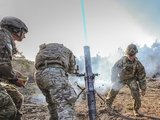
![Cubic tailors mortar simulator for the US Army]()
Cubic tailors mortar simulator for the US Army
The company’s mortar trainer received improvements based on soldier’s feedback.
-
![Saab expands footprint in the US]()
Saab expands footprint in the US
The company will operate in two new locations in the coming years to better support US services.
-
![How terrain management capabilities can improve military training]()
How terrain management capabilities can improve military training
This type of tool provides more realistic training easing the incorporation of new scenarios that accurately represent the threats of the battlefield.
-
![I/ITSEC 2024: Australian Army approaches second phase of countermining training]()
I/ITSEC 2024: Australian Army approaches second phase of countermining training
The Engineering Corps has been conducting individual instruction using FLAIM Systems’ Sweeper and should start collective deployments in 2025.
-
![I/ITSEC 2024: Zeiss introduces Velvet 4K SIM projector for night flight simulation]()
I/ITSEC 2024: Zeiss introduces Velvet 4K SIM projector for night flight simulation
The next-generation platform is motion-compatible and can be used in OTW and NVG applications.
-
![I/ITSEC 2024: Saab introduces UAV live training capability]()
I/ITSEC 2024: Saab introduces UAV live training capability
The system can be used to prepare soldiers for both drone offensive operations and CUAS missions.