PAR Government to launch upgraded geospatial analysis tool
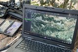
COTS variant of the GV3.0 raster imagery and full-motion video viewing package, which is also used by US defence and intelligence agencies. (Photo: PAR Government)
US-based geospatial systems specialist PAR Government is unveiling an upgraded and redesigned version of its GV3.0 raster imagery and full-motion video (FMV) viewing package on 5-8 October 2021 at the GEOINT 2021 event in St Louis, Missouri.
GV-X ‘will appeal to traditional geospatial end users, especially those who perform analysis of FMV from unmanned aerial vehicles (UAVs) and other remote sensing platforms’, PAR Government noted in a 21 Sept.
Company president Matt Cicchinelli claimed the main benefit of GV-X is the ‘access it provides FMV users to the metadata embedded in video streams that allows for advanced geospatial analysis’.
PAR developed GV3.0 in the early 2000s for use solely by the US defence, intelligence and geospatial imagery communities, to view and analyse various types of raster imagery and FMV captured by satellites, UASs and manned aircraft.
It is now also available on the commercial market.
More from Digital Battlespace
-
![Babcock nears first customer for Nomad AI translation tool]()
Babcock nears first customer for Nomad AI translation tool
Nomad can provide militaries with real-time intelligence, saving critical time on the battlefield.
-
![AUSA 2025: Israel’s Asio Technologies to supply hundreds of improved Taurus tactical systems]()
AUSA 2025: Israel’s Asio Technologies to supply hundreds of improved Taurus tactical systems
Taurus operates alongside the Israel Defense Forces’ Orion system which supports mission management across tens of thousands of manoeuvring forces, from squad leaders to battalion commanders.
-
![AUSA 2025: Kopin pushes micro-LED plans as China moves faster]()
AUSA 2025: Kopin pushes micro-LED plans as China moves faster
The plan for the new displays follows fresh investment in Kopin’s European facilities by Theon and an order for head-up displays in fielded aircraft, with funding from the US Department of Defense.
-
![AUSA 2025: Persistent Systems to complete its largest order by year’s end]()
AUSA 2025: Persistent Systems to complete its largest order by year’s end
Persistent Systems received its largest ever single order for its MPU5 devices and other systems earlier this month and has already delivered the 50 units to the US Army’s 4th Infantry Division.
-
![Aselsan brings in dozens of companies and systems under the Steel Dome umbrella]()
Aselsan brings in dozens of companies and systems under the Steel Dome umbrella
Turkey has joined the family of countries attempting to establish a multilayered air defence system with government approval in August 2024 for the effort landed by Aselsan. Dubbed Steel Dome, the programme joins Israel’s Iron Dome, the US Golden Dome, India’s Mission Sudarshan Chakra and South Korea’s low-altitude missile defence system.


