Artemis and AIMS-ISR integrate for cellular location
CarteNav brings new capabilities to Smith Myers' Artemis geo-location software. (Image: CarteNav)
CarteNav and Smith Myers have turned mobile phones into rescue beacons through Artemis and AIMS-ISR software integration.


CarteNav and Smith Myers have announced the integration of Smith Myers’ Artemis Mobile Phone detection, location and communication sensor with CarteNav’s AIMS-ISR mission software.
This partnering will allow airborne operators to identify, locate and communicate with any target by their cellular device, turning into a geo-referenced cellular track.
The Artemis system is designed to maximise the ability to detect a phone at extended ranges and to provide unique capabilities while minimising crew workload.
Artemis and AIMS-ISR work together to provide operators with cellular tracks geo-referenced on augmented moving maps alongside other equipped sensors such as EO/IR track following.
Andrew Munro, Company Director at Smith Myers, noted the system’s ability to lock onto a mobile phone’s location from 20km+, saying: ‘The bottom line is that this leads to more rapid positive outcomes while rescuing operator workload.’
According to Shephard Defence Insight, in the right conditions, Artemis can detect a specific mobile phone at distances in excess of 30km.
It may detect a phone from a list or, in disaster situations, or any mobile phone in a geographic area.

More from Defence Notes
-
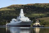
![UK faces cost of balancing defensive capabilities abroad as Iran conflict widens]()
UK faces cost of balancing defensive capabilities abroad as Iran conflict widens
The UK has recently deployed a Type 45 destroyer to Cyprus and has bolstered its presence in the Middle East in recent weeks with supporting air power to protect neighbouring countries’ air defences.
-
![White House calls on Pentagon contractors to “rapidly and aggressively” boost weapon production]()
White House calls on Pentagon contractors to “rapidly and aggressively” boost weapon production
Intended to sustain Operation Epic Fury against Iran, efforts to increase the production of weapons and ammunition could expose long-standing weaknesses in the US defence industrial base.
-
![India’s strategic defence footprint expansion could be accelerated by Iran-Israel conflict]()
India’s strategic defence footprint expansion could be accelerated by Iran-Israel conflict
The latest escalation between Iran and Israel could shape New Delhi’s next-generation shield as India deepens cooperation with Israel on missile defence and drone production.
-
![Is the US magazine of air defence interceptors deep enough to sustain a long campaign against Iran?]()
Is the US magazine of air defence interceptors deep enough to sustain a long campaign against Iran?
The Pentagon spent a considerable number of THAAD and SM-3 rounds to defend against Iranian missiles in 2025 and has not fully replenished its reserves.
-
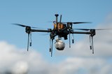
![New Zealand buys tri-service uncrewed kit from Syos Aerospace]()
New Zealand buys tri-service uncrewed kit from Syos Aerospace
As uncrewed technology continues to play an increasingly central role in modern military activities, New Zealand’s recent acquisitions point towards its the force’s focus on cost-effective capability.