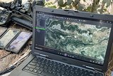
Saab, DigitalGlobe partner for 3D mapping
Saab has announced that it will partner with DigitalGlobe, a leading global provider of high-resolution earth imagery solutions, to deliver the next-generation of Saab’s Vricon Rapid 3D Mapping System.
The agreement will see DigitalGlobe’s satellite imagery collections and extensive image archive integrated into the Vricon solution, enabling faster creation of highly-accurate, photo-realistic 3D maps of specific areas of interest.
The Vricon system automatically and rapidly generates high resolution 3D data based on imagery from satellites, UAVs and manned aircraft. Vricon is built for integration in additional systems and applications, such as intelligence reporting, mission planning and rehearsal, training and simulation as well as coordinate extraction and georeferencing of intelligence, surveillance and reconnaissance (ISR) sensors.
Fredrik Rosenqvist, President of Vricon Systems at Saab, said: ‘This partnership between Saab and DigitalGlobe represents a significant step forward in the geo intelligence community. It provides our customers with on-time access to high resolution 3D data based on satellite imagery.’
More from Digital Battlespace
-
![Thales looks to boost DigitalCrew system through AI and human-machine teaming trials]()
Thales looks to boost DigitalCrew system through AI and human-machine teaming trials
The Thales DigitalCrew package, first unveiled at last year’s Defence IQ International Armoured Vehicles conference, is designed to merge imaging and apply a layer of decision-making and observation algorithms to support crew and other personnel.
-
![Babcock nears first customer for Nomad AI translation tool]()
Babcock nears first customer for Nomad AI translation tool
Nomad can provide militaries with real-time intelligence, saving critical time on the battlefield.
-
![AUSA 2025: Israel’s Asio Technologies to supply hundreds of improved Taurus tactical systems]()
AUSA 2025: Israel’s Asio Technologies to supply hundreds of improved Taurus tactical systems
Taurus operates alongside the Israel Defense Forces’ Orion system which supports mission management across tens of thousands of manoeuvring forces, from squad leaders to battalion commanders.
-
![AUSA 2025: Kopin pushes micro-LED plans as China moves faster]()
AUSA 2025: Kopin pushes micro-LED plans as China moves faster
The plan for the new displays follows fresh investment in Kopin’s European facilities by Theon and an order for head-up displays in fielded aircraft, with funding from the US Department of Defense.
-
![AUSA 2025: Persistent Systems to complete its largest order by year’s end]()
AUSA 2025: Persistent Systems to complete its largest order by year’s end
Persistent Systems received its largest ever single order for its MPU5 devices and other systems earlier this month and has already delivered the 50 units to the US Army’s 4th Infantry Division.


