Australia details Land 1771 Tranche 1 investment
The Australian government has detailed plans to invest $150 million in the Australian Army’s next-generation geospatial support capability.
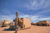
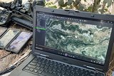
Forming part of the Land 1771 Tranche 1 project, land forces will gain new imagery capabilities to obtain vital terrain and navigation data, enabling army commanders to make faster decisions while on the battlefield.
Minister for Defence, Linda Reynolds, said: ‘The new Geospatial Support System (GSS) will not only ensure our land forces are more effective and efficient, but will also keep our serving personnel safer on operations by providing commanders with a greater understanding of their operating environment.
‘The Morrison government is investing around $500 million in acquisition and $400 million in sustainment of army’s geospatial capabilities over the next 15 years.’
Land 1771 Phase 1 GSS will modernise and automate the land geospatial capability to deliver enhanced geospatial collection, analysis, dissemination and management with minimum production time and effort. Land 1771 Ph 1 will enhance situational awareness, contribute to the foundation layers of the common operating picture and provide tactical terrain analysis to the military appreciation process. The project will provide geodetic and littoral survey equipment, networked geospatial and imagery analysis computer systems, and a geospatial data collection capability.
Tranche 2 of Land 1771 will provide opportunities for Australian industry to partner with academia in areas such as advanced sensors, machine learning and artificial intelligence.
More from Digital Battlespace
-
![Babcock nears first customer for Nomad AI translation tool]()
Babcock nears first customer for Nomad AI translation tool
Nomad can provide militaries with real-time intelligence, saving critical time on the battlefield.
-
![AUSA 2025: Israel’s Asio Technologies to supply hundreds of improved Taurus tactical systems]()
AUSA 2025: Israel’s Asio Technologies to supply hundreds of improved Taurus tactical systems
Taurus operates alongside the Israel Defense Forces’ Orion system which supports mission management across tens of thousands of manoeuvring forces, from squad leaders to battalion commanders.
-
![AUSA 2025: Kopin pushes micro-LED plans as China moves faster]()
AUSA 2025: Kopin pushes micro-LED plans as China moves faster
The plan for the new displays follows fresh investment in Kopin’s European facilities by Theon and an order for head-up displays in fielded aircraft, with funding from the US Department of Defense.
-
![AUSA 2025: Persistent Systems to complete its largest order by year’s end]()
AUSA 2025: Persistent Systems to complete its largest order by year’s end
Persistent Systems received its largest ever single order for its MPU5 devices and other systems earlier this month and has already delivered the 50 units to the US Army’s 4th Infantry Division.


