US and UK military targeted for GPS-free navigation system for UAVs in contested environments
The capability was built with the intention of enabling operation in any weather and terrain. (Photo: Flare Bright)
Flare Bright TACTERA software solution will be introduced at SOF Week 2025 in Tampa this week.


The TACTERA software solution, produced by UK aerospace supplier Flare Bright, will be unveiled this week at the SOF Week 2025 exhibition in Tampa, Florida, as it targets potential interest in GPS-free navigation systems for drones deployed in contested environments from the US and UK militaries.
According to Flare Bright, the development of the capability has received resources from the UK Ministry of Defence and the US Army Combat Capabilities Development Command C5ISR Center (DEVCOM C5ISR). Both countries have already tested the system while it was being built.
Speaking to Shephard, Flare Bright CEO Kelvin Hamilton explained that TACTERA was engineered
Our news & analysis is now part of Defence Insight®
A Basic-level or higher Defence Insight subscription is now required to view this content.


More from Air Warfare
-
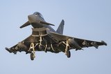
![Rapid APKWS integration sparks “strong” demand from Typhoon customers]()
Rapid APKWS integration sparks “strong” demand from Typhoon customers
The recent operational use and success of the APKWS laser-guidance kit on the UK RAF's Typhoons has driven demand from other Eurofighter customers for integration of the system on their own combat aircraft fleet, according to BAE Systems.
-
![Eurosatory 2026: MBDA and Thales look to civilian industry for loitering munition scale-up]()
Eurosatory 2026: MBDA and Thales look to civilian industry for loitering munition scale-up
Thales and MBDA have taken steps to ensure the mass production of their respective loitering munition offerings at Eurosatoy, teaming with civilian manufacturers. These moves come amid France’s push towards sovereign drone production and continued market expansion.
-
![Only 25% of the US Pentagon’s F-35 fleet has been fully mission capable, GAO says]()
Only 25% of the US Pentagon’s F-35 fleet has been fully mission capable, GAO says
The fighter jet remains a combat necessity, but sustainment challenges continue to limit its readiness. In the meantime, the US Air Force seeks billions in funding to improve the F-35's availability.