Tracking trafficked weapons using CAR’s StoryMap
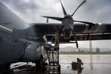
CAR shows the movement of illicit weapons to Nigeria's herder-farmer conflict. (Image: Conflict Armament Research)
Esri UK awards CAR 2021 Map Creator Customer Award for a visual tool to track the trafficking of illicit weapons.


Conflict Armament Research has been awarded the 2021 Map Creator Customer Award by Esri UK for its creation of a StoryMap approach to visually communicate its findings and inform UN and EU policymakers.
CAR investigates illicit weapons supplies into conflict zones.
CAR published its first StoryMap using Esri’s ArcGIS Online in February 2020 to report on Nigeria’s herder-farmer conflict, which has mainly involved the nation’s Christian and Muslim Fulani rural populations.
The map was derived from evidence collected through its first field study on the trafficking of weapons and ammunition to armed groups in Northern Nigeria.
CAR extracted this data from spreadsheets and used it to create a story, explored through three case studies, of how these groups were being armed.
Using Esri’s terrain map CAR can show the movements of weapons from Turkey, the Ivory Coast and Libya.
CAR uses ArcGIS capabilities for its database on diverted weapons and ammunition into conflict zones.
CAR has also created iTrace to aid national arms export control agencies in identifying diversion risks prior to export.
iTrace automatically quantifies diversion risks and profiles the sources of diversion nationally, regionally, and globally.


More from Defence Notes
-
![Canada seeks to strengthen industrial ties with the US on classified programmes]()
Canada seeks to strengthen industrial ties with the US on classified programmes
Ottawa explores expanding defence-industrial cooperation with Washington into sensitive programmes, an approach that could reshape NORAD modernisation, strengthen North American supply chains and create new opportunities for defence contractors.
-
![UK’s latest defence robotics and autonomy competition looks to break new ground]()
UK’s latest defence robotics and autonomy competition looks to break new ground
The UK Ministry of Defence is backing early-stage, high-risk autonomy concepts that could redefine how military systems are developed and deployed.
-
![How AI is reshaping defence procurement through sustainment]()
How AI is reshaping defence procurement through sustainment
Artificial intelligence is not just changing how defence equipment is maintained but how defence programmes are won, creating new opportunities for industry by influencing acquisition decisions and shaping competition.
-
![NATO signs agreements worth billions of dollars on missiles, air defence and aircraft]()
NATO signs agreements worth billions of dollars on missiles, air defence and aircraft
Announcements on aircraft deals and agreements for trans-alliance cooperation to boost the production and purchase of weapons and equipment were key takeaways from this week’s NATO summit.