UK accepts digital mapping system for Afghanistan
Apache and Tornado crews in Afghanistan are putting the bane of ‘cockpit origami’ behind them with a new electronic map.
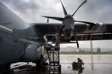
Because of the nature of international operations in Afghanistan, crewmen on both types of aircraft have to carry a vast range of maps covering the country to be able to work with troops on the ground. This can mean that dozens of charts of varying different scales can end up littering the already cramped cockpit, a problem referred to as ‘cockpit origami’ by the UK Apache community.
However, an end is in sight as units in Afghanistan are taking delivery
Our news & analysis is now part of Defence Insight®
A Basic-level or higher Defence Insight subscription is now required to view this content.


More from Defence Helicopter
-
![Germany to send WS-61 Westland Sea King helicopters to Ukraine]()
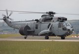
Germany to send WS-61 Westland Sea King helicopters to Ukraine
Germany has committed to sending Ukraine six of its 21 retiring WS-61 Westland Sea King multirole, amphibious helicopters.
-
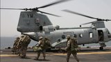
![Boeing secures $271 million to advance modernisation of US Special Operations' MH-47G Chinook]()
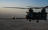
Boeing secures $271 million to advance modernisation of US Special Operations' MH-47G Chinook
Boeing has clinched a major contract modification to further its backing of the US Special Operations Command’s MH-47G Chinook aircraft modernisation effort.
-
![Dubai Airshow 2023: South Korean homegrown helicopters make international debut]()
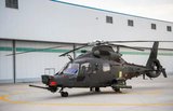
Dubai Airshow 2023: South Korean homegrown helicopters make international debut
Two KAI helicopters, the KUH-1E utility helicopter and the Light Attack Helicopter (LAH), have taken centre stage at the Dubai Airshow 2023.
-
![Italian Navy receives final NH90 helicopter]()
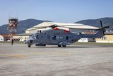
Italian Navy receives final NH90 helicopter
The Italian Navy now boasts a fleet of 56 NH90 helicopters comprising 46 SH-90As and 10 MH-90As.
-
![Argentina seeks AW109 and CH-46 Sea Knight helicopters]()
Argentina seeks AW109 and CH-46 Sea Knight helicopters
The Argentinian Air Force (FAA) and the Argentinian Naval Aviation Command (COAN) are looking for options to upgrade their helicopter fleets.
-
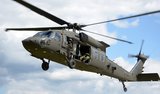
![DSEI 2023: Lockheed to produce about 40% of Black Hawks on UK soil if it wins NMH contest]()
DSEI 2023: Lockheed to produce about 40% of Black Hawks on UK soil if it wins NMH contest
Lockheed Martin promises a boost to the British job market and export opportunities, while strengthening ties with Poland and positioning the UK for a future in rotorcraft technology in the event of a New Medium Helicopter competition triumph.