How complete is your Recognised Maritime Picture?
Deploy SitaWare Maritime to master your situational awareness above and below the waves


This article is brought to you by Systematic
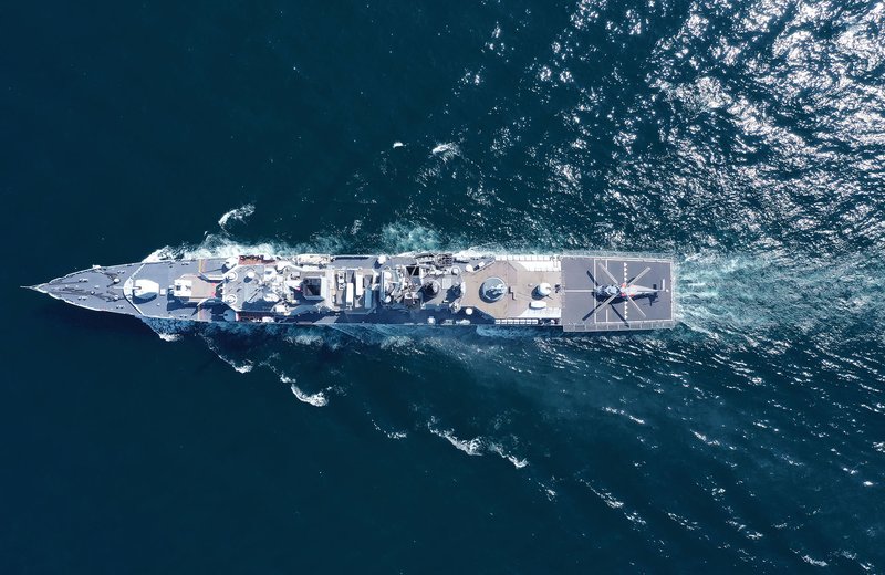
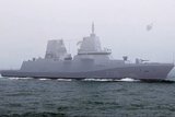
While the open sea may look vast and empty to those standing watch, there can be a myriad of friendly, civilian, and enemy assets operating above and below the waterline that need to be taken into consideration when naval vessels are operating.
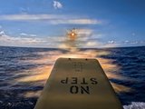
Monitoring and tracking vessels, aircraft, and other above-water objects is made easier by a combination of radar systems and open-source data feeds, such as ADS-B and AIS. Monitoring subsurface objects, ranging from submarines to undersea infrastructure, has some different requirements. Operating in conjunction with friendly submarine forces means effective management of the subsurface space, knowing a submarine’s location and planned movements to avoid interference and maximise intelligence gathering and dissemination efforts.
WaterSpace Management (WSM) facilitates the coordination of sub-surface warfare aimed at locating and engaging enemy submarines and other sub-surface vehicles. This capability also ensures a synchronised deployment of weapons among own submarines, surface ships, and aircraft. WSM operates within various designated areas with specific purposes, including specific WSM areas designated for either exclusive submarine use or a combination of forces, submarine patrol areas, and no-attack areas.
“WaterSpace Management is a critical capability for the safe coordination of the movements of submarine and underwater vessels,” said Stig Meyer, Product Manager for SitaWare Maritime.
“That’s why we have paid particular attention to this aspect. Now operators can create a moving haven for the area in which a submarine will operate, and pin that to a pre-planned route. This will automatically calculate the position of the submarine as it travels by calculating the distance and speed.
“This then becomes visible for all users of SitaWare, informing their situational awareness and allowing them to plan their own movements safely and effectively. It’s an important feature in the software and one that we think our customers will greatly benefit from as a result.”
This functionality means that operators can now import APP-11 subnotes, allowing them to visualise planned submarine movements directly on the map. This enhances operational planning by providing a clear, real-time view of submarine operations alongside other maritime assets.
Joint operations from a single screen
SitaWare Maritime takes together a wide variety of sensor inputs in multiple formats – including OTH-Gold, APP-11, AIS, Link 16, MIP, and more – and helps to fuse them into a single screen. Utilising map layers, maritime operations staff can gather intelligence from across domains to build an information-rich situational overview, make key operational decisions, and ensure that intelligence is shared across all domains to a wide variety of users.
This capability helps to reduce the stovepipes that can be created between maritime and land commanders, particularly when undertaking amphibious operations or when leveraging maritime assets and capabilities to deliver effects against air and ground targets.
The ability to relay the view from a deployed ship additionally means that on-the-scene commanders can share their planned intentions with senior commanders ashore; thereby reducing the role of the “long-handled screwdriver” in maritime operational command.
Intelligence-led decision making
SitaWare Maritime also utilises SitaWare Fusion, a plug-in that performs correlation and analysis of sensor tracks to ensure that full data fidelity of objects in the operating environment. When multiple sensors pick up an object and track it, SitaWare Fusion helps to de-duplicate, while providing redundancy in case a sensor loses contact with an object of interest.
Leveraging this track correlation and fusion capability, users are also able to set up alerting for objects or activities of interest. This can range from suspicious contacts between vessels, the presence of vessels in areas where they may otherwise not normally operate, or deviation from standard courses. The creation of an alerting system means that commanders can be made aware of potential threats and changes to the RMP as early as possible.
Click here to find out more about SitaWare Maritime, or listen to our recent podcast on Submarines and C2 here.

More from Industry Spotlights
-
![The speed of relevance: how companies can navigate the new era of European defence procurement]()
The speed of relevance: how companies can navigate the new era of European defence procurement
European militaries face a rapidly evolving security landscape and defence production must accelerate to meet surging demand for platforms and equipment. Industry needs to adapt to ensure it gets its products into the hands of the end user, Evelyn Rafferty, Senior Director Aerospace and Defence - Europe at Plexus told Shephard’s Gerrard Cowan.
-
![Patria TRACKX: Designed to conquer the most challenging environments]()
Patria TRACKX: Designed to conquer the most challenging environments
The tracked all-terrain armoured vehicle Patria TRACKX is a promise of performance. It is engineered to navigate the toughest terrain silently and swiftly, ensuring smooth operations in any conditions.
-
![“A staggering rate of change”: how experience combating IEDs is being applied to the C-UAS arena]()
“A staggering rate of change”: how experience combating IEDs is being applied to the C-UAS arena
The scale of the current escalation in drone attacks is fuelling demand for C-UAS technology that must address a rapidly evolving and expanding threat. Against this background, important lessons can be learned from the battle against IEDs, with networked responses and dispersed capabilities essential to deliver enduring protection.
-
![Agile, sovereign, edge-ready: rewiring defence IT for a contested decade]()
Agile, sovereign, edge-ready: rewiring defence IT for a contested decade
Today's rapidly changing security landscape means that armed forces can no longer treat their data in the same way as in the past. What are the key challenges they face, and how can industry help them?
-
![The science of soldier safety: How Team Wendy Is reinventing the modern military helmet]()
The science of soldier safety: How Team Wendy Is reinventing the modern military helmet
When soldiers head into the field, the helmet on their head can mean the difference between life and death. But while helmets may look simple from the outside, the technology inside them is anything but. Few companies illustrate this better than Team Wendy, whose newest bump helmet — the RECON™ Tactical — shows just how far modern head protection has come.
-
![DVD2026: Connected for Combat]()
DVD2026: Connected for Combat
As the land equipment sector prepares for the premier biennial event at UTAC Millbrook on 16 and 17 September 2026, the narrative for this year’s exhibition has officially been set: Connected for Combat - Aligning People, Systems and Decisions.