
Raytheon missile warning data processing system declared operational
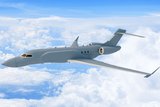
The Raytheon ground element can process data from OPIR space vehicles. (Image: Raytheon)
Raytheon’s Future Operationally Resilient Ground Evolution Mission Data Processing Application Framework (FORGE MDPAF) is designed as a modular and adaptable framework to provide integration of mission focused applications to handle information from satellites.


Raytheon’s system to process, exploit and disseminate information from the US Space Force’s Space Based Infrared System (SBIRS) constellation, used to provide space-based missile warning, has been declared as operational.
FORGE MDPAF is used to process Overhead Persistent Infrared (OPIR) satellite data from both the SBIRS constellation and the future Next Gen OPIR constellation, as well as processing data from other civil and environmental sensors.
In January this year, Raytheon Intelligence & Space was awarded a contract to develop a prototype Missile Track Custody (MTC) system, the service’s first medium Earth orbit (MEO) missile tracking capability, this will also use FORGE MDPAF.
In 2020 Raytheon was awarded a US$197 million contract from USAF contract to design the system which generates warnings, alerts and other information for combatants and eventually, civilian first responders and researchers.
At the time of the 2020 contract award, a company official noted that “the US government’s global satellite network produces a constant flood of data — petabytes and petabytes of it every day.
“Essentially, this is a smartphone model,” the official said. “We’ve built an operating system that everyone can build applications for – from Raytheon to the USAF to universities to small companies. These applications allow the system to process specific types of data.”
An example noted by the company is that an application could be built that would allow civil agencies to use the same satellite data to help detect forest fires, volcanic activity, agricultural changes and even surges in electric power consumption.


More from Digital Battlespace
-
![SOF Week 2026: How SOF Teams Are Powering Radios, Drones and Battlefield Networks (video)]()
SOF Week 2026: How SOF Teams Are Powering Radios, Drones and Battlefield Networks (video)
At SOF Week 2026, Sean O’Neill, Senior Business Development Manager with Iris Technology, discusses the growing importance of tactical power management systems for modern military operations.
-
![SOF Week 2026: How SOF Operators Are Driving the Future of Battlefield Communications (video)]()
SOF Week 2026: How SOF Operators Are Driving the Future of Battlefield Communications (video)
At SOF Week 2026, Austin Farnham, President of Octane Wireless, discusses how direct feedback from special operations forces is helping shape the next generation of battlefield communications technology.
-
![World Defense Show 2026: Northrop Grumman to present improved C2 management system]()
World Defense Show 2026: Northrop Grumman to present improved C2 management system
The Northrop Grumman Integrated Battle Command System is in service with Poland and the US Army with another 20 countries believed to have expressed an interest.
-
![Thales looks to boost DigitalCrew system through AI and human-machine teaming trials]()
Thales looks to boost DigitalCrew system through AI and human-machine teaming trials
The Thales DigitalCrew package, first unveiled at last year’s Defence IQ International Armoured Vehicles conference, is designed to merge imaging and apply a layer of decision-making and observation algorithms to support crew and other personnel.
-
![Babcock nears first customer for Nomad AI translation tool]()
Babcock nears first customer for Nomad AI translation tool
Nomad can provide militaries with real-time intelligence, saving critical time on the battlefield.
-
![AUSA 2025: Israel’s Asio Technologies to supply hundreds of improved Taurus tactical systems]()
AUSA 2025: Israel’s Asio Technologies to supply hundreds of improved Taurus tactical systems
Taurus operates alongside the Israel Defense Forces’ Orion system which supports mission management across tens of thousands of manoeuvring forces, from squad leaders to battalion commanders.


