BAE Systems adds new capabilities to GEOINT software
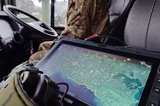
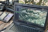
BAE Systems has added new capabilities to its geospatial-intelligence (GEOINT) software, providing enhancements that allow customers to import high-resolution imagery from scanned film and digital airborne sensors. The company's SOCET GXP software automates image processing to make analysts more responsive in the operational environment.
Film and digital airborne sensors are the primary data sources for many geospatial analysts, particularly in commercial and global markets where acquiring satellite imagery is often not feasible. BAE Systems developed a step-by-step wizard interface to simplify the frame import process, reducing the time required for image processing. Advanced image processing algorithms assist operators with change detection, image classification, identifying anomalies and tracking patterns of activity over time.
"The Frame-Advanced sensor model is used in the geospatial production process from frame import through image registration to creating finished products," said Stewart Walker, director of product initiatives for the Geospatial eXploitation Products business. "Analysts can more efficiently and accurately create photogrammetric products, such as topographic map data and high-resolution digital surface and elevation models."
The SOCET GXP v3.2 software release also adds automated tools for viewing and editing live video feeds, and efficient tools for converting terrain analysis results from raster to vector file format. Furthermore, hyperspectral and multispectral image processing is extended with the capacity to analyze additional bands of image data, which minimizes the dependency on specialized software packages. Using these tools, analysts can more precisely identify ground features such as distinguishing between camouflaged fatigues and trees.
SOCET GXP is a geospatial-intelligence software package that uses imagery from satellite and aerial sources to identify and analyze ground features quickly, allowing for rapid product creation. The software is used to document geographic attributes in images and live video feeds and establish patterns of activity over time, which broadens analytical expertise.
SOCET GXP v3.2 is available on Microsoft Windows XP, Vista, 7 and Solaris 10 x 86 operating systems.
Source: BAE Systems
More from Digital Battlespace
-
![World Defense Show 2026: Northrop Grumman to present improved C2 management system]()
World Defense Show 2026: Northrop Grumman to present improved C2 management system
The Northrop Grumman Integrated Battle Command System is in service with Poland and the US Army with another 20 countries believed to have expressed an interest.
-
![Thales looks to boost DigitalCrew system through AI and human-machine teaming trials]()
Thales looks to boost DigitalCrew system through AI and human-machine teaming trials
The Thales DigitalCrew package, first unveiled at last year’s Defence IQ International Armoured Vehicles conference, is designed to merge imaging and apply a layer of decision-making and observation algorithms to support crew and other personnel.
-
![Babcock nears first customer for Nomad AI translation tool]()
Babcock nears first customer for Nomad AI translation tool
Nomad can provide militaries with real-time intelligence, saving critical time on the battlefield.
-
![AUSA 2025: Israel’s Asio Technologies to supply hundreds of improved Taurus tactical systems]()
AUSA 2025: Israel’s Asio Technologies to supply hundreds of improved Taurus tactical systems
Taurus operates alongside the Israel Defense Forces’ Orion system which supports mission management across tens of thousands of manoeuvring forces, from squad leaders to battalion commanders.
-
![AUSA 2025: Kopin pushes micro-LED plans as China moves faster]()
AUSA 2025: Kopin pushes micro-LED plans as China moves faster
The plan for the new displays follows fresh investment in Kopin’s European facilities by Theon and an order for head-up displays in fielded aircraft, with funding from the US Department of Defense.
-
![AUSA 2025: Persistent Systems to complete its largest order by year’s end]()
AUSA 2025: Persistent Systems to complete its largest order by year’s end
Persistent Systems received its largest ever single order for its MPU5 devices and other systems earlier this month and has already delivered the 50 units to the US Army’s 4th Infantry Division.


