
KERKES gives Turkey capability to operate drones in GPS-denied environment
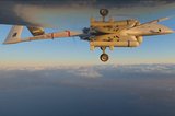
Rendering of a KERKES-equipped UAV. (Image: STM Defence)
With the help of AI and object recognition technology, KERKES helps UAVs perform missions in environments where there is no GPS coverage or active RF jamming.


STM Defence has delivered the KERKES GPS-independent autonomous navigation system to the Turkish military, enabling drone swarms to be controlled in contested electromagnetic environments.
STM launched KERKES in 2019 with support from the Turkish defence procurement agency SSB. The project sought to enable accurate location data and mission execution by using object recognition technology and AI with deep-learning capabilities.
With KERKES, a UAV begins its mission with a pre-loaded map. The map is then compared with data gathered during the flight.
Final acceptance testing of the system was completed in early October.
SSB chief Ismail Demir took to social media
Our news & analysis is now part of Defence Insight®
A Basic-level or higher Defence Insight subscription is now required to view this content.

More from Uncrewed Vehicles
-
![The shift away from Chinese drone technology presents supplier opportunities]()
The shift away from Chinese drone technology presents supplier opportunities
As countries increasingly move away from Chinese drone manufacturing and focus on domestic production and collaboration, Europe and the US are well-placed to step in – although cost remains a crucial consideration.
-
![What’s next for the Pentagon after the Replicator programme?]()
What’s next for the Pentagon after the Replicator programme?
Although the Replicator initiative has made several accomplishments, there are still multiple gaps to plug across the US Department of Defense (DoD) and its services.
-
![Cummings Aerospace showcases Hellhound loitering munition designed for US Army’s LASSO programme (video)]()
Cummings Aerospace showcases Hellhound loitering munition designed for US Army’s LASSO programme (video)
Cummings Aerospace presented its turbojet-powered Hellhound loitering munition at SOF Week 2025, offering a man-portable solution aligned with the US Army’s LASSO requirements.
-
![SOF Week 2025: PDW unveils attritable FPV drone for SOF operations at scale]()
SOF Week 2025: PDW unveils attritable FPV drone for SOF operations at scale
PDW has revealed its Attritable Multirotor First Person View drone at SOF Week 2025, offering special operations forces a low-cost, rapidly deployable platform for strike and ISR missions, inspired by battlefield lessons from Ukraine.
-
![SOF Week 2025: Teledyne FLIR white paper provides guidance on reusable loitering munitions]()
SOF Week 2025: Teledyne FLIR white paper provides guidance on reusable loitering munitions
Teledyne FLIR is highlighting the emerging requirements for 'recoverable and re-usable' loitering munitions across the contemporary operating environment during this week’s SOF Week conference in Tampa, Florida.
-
![SOF Week 2025: Kraken Technology group debuts K3 Scout USV in North America]()
SOF Week 2025: Kraken Technology group debuts K3 Scout USV in North America
High-performance maritime industry player Kraken Technology Group, based in the UK, has used the SOF Week conference in Tampa, Florida this week to debut its K3 Scout uncrewed surface vessel (USV) to the North American market.


