
ATK and Hughes complete USAF weather satellite study


An ATK-led team has completed a 12 month study into network-centric small satellites for future weather systems with a demonstration of the technology on 14 November, the company has revealed.
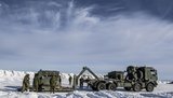
Demonstrations took place in July and November 2013, during which a ‘comprehensive end-to-end, ground-based demonstration’ of an architecture that could eventually be implemented in a next-generation operational system was tested.
An operational system would leverage existing commercial satellite infrastructure to reduce operational costs and shorten delays in transmitting data used for military, scientific or disaster recovery exercises.
The study was for the USAF Space and Missile Systems Center under the Weather Satellite Follow-On Activities Risk Reduction Technology Project, led by prime contractor ATK and subcontractors Hughes Network Systems and NASA’s Jet Propulsion Laboratory.
The team used hand-held devices to display final data products, and validated the impact of a more nimble configuration of networked systems that can meet the needs of new missions.
‘The concept of using small, affordable, disaggregated satellites to replace the current generation of complex and costly multi-sensor weather satellites is being embraced by both the Department of Defense and the Government Accountability Office,’ ATK said in a 12 December statement.
To establish the utility of such architectures, ATK studied the capability of its A200 small satellite bus used in ORS-1 and TacSat-3 missions for the DoD to accommodate a wide variety of weather sensors as a part of the study.
Another objective of the study shown in the demonstration characterised the advantages of transferring data from a Low Earth Orbit (LEO) satellite to a Geosynchronous Earth Orbit (GEO) communications satellite for direct insertion into a commercial data network and cloud-based information environment, in accordance with the DoD’s Information Assurance guidelines.
‘Such an approach will provide for the rapid delivery of data to mobile end users while simultaneously reducing the workload on the Air Force Satellite Control Network,’ the statement continued.


More from Digital Battlespace
-
![SOF Week 2026: How SOF Teams Are Powering Radios, Drones and Battlefield Networks (video)]()
SOF Week 2026: How SOF Teams Are Powering Radios, Drones and Battlefield Networks (video)
At SOF Week 2026, Sean O’Neill, Senior Business Development Manager with Iris Technology, discusses the growing importance of tactical power management systems for modern military operations.
-
![SOF Week 2026: How SOF Operators Are Driving the Future of Battlefield Communications (video)]()
SOF Week 2026: How SOF Operators Are Driving the Future of Battlefield Communications (video)
At SOF Week 2026, Austin Farnham, President of Octane Wireless, discusses how direct feedback from special operations forces is helping shape the next generation of battlefield communications technology.
-
![World Defense Show 2026: Northrop Grumman to present improved C2 management system]()
World Defense Show 2026: Northrop Grumman to present improved C2 management system
The Northrop Grumman Integrated Battle Command System is in service with Poland and the US Army with another 20 countries believed to have expressed an interest.
-
![Thales looks to boost DigitalCrew system through AI and human-machine teaming trials]()
Thales looks to boost DigitalCrew system through AI and human-machine teaming trials
The Thales DigitalCrew package, first unveiled at last year’s Defence IQ International Armoured Vehicles conference, is designed to merge imaging and apply a layer of decision-making and observation algorithms to support crew and other personnel.
-
![Babcock nears first customer for Nomad AI translation tool]()
Babcock nears first customer for Nomad AI translation tool
Nomad can provide militaries with real-time intelligence, saving critical time on the battlefield.
-
![AUSA 2025: Israel’s Asio Technologies to supply hundreds of improved Taurus tactical systems]()
AUSA 2025: Israel’s Asio Technologies to supply hundreds of improved Taurus tactical systems
Taurus operates alongside the Israel Defense Forces’ Orion system which supports mission management across tens of thousands of manoeuvring forces, from squad leaders to battalion commanders.


