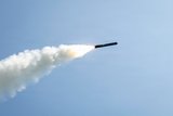
Dubai Airshow 2011: Google Earth assists Pakistan Air Force in border operations


The Pakistan Air Force (PAF) was forced to use Google Earth to plan its early missions against militants fighting in the border regions with Afghanistan.
Speaking on the eve of the Dubai Airshow, Air Chief Marshal Rao Qamar Suleiman, chief of the Pakistan Air Force, told delegates that at the beginning of its counter insurgency operations in the Bajaur Agency region in August 2008, the air force did not have the intelligence-gathering capabilities it needed for detailed mission planning.
As a result, it had to resort to use Google Earth software to plan the missions.
'It was not very useful,
Already have an account? Log in
Want to keep reading this article?


More from Defence Notes
-
![White House calls on Pentagon contractors to “rapidly and aggressively” boost weapon production]()
White House calls on Pentagon contractors to “rapidly and aggressively” boost weapon production
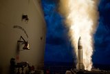
Intended to sustain Operation Epic Fury against Iran, efforts to increase the production of weapons and ammunition could expose long-standing weaknesses in the US defence industrial base.
-
![India’s strategic defence footprint expansion could be accelerated by Iran-Israel conflict]()
India’s strategic defence footprint expansion could be accelerated by Iran-Israel conflict
The latest escalation between Iran and Israel could shape New Delhi’s next-generation shield as India deepens cooperation with Israel on missile defence and drone production.
-
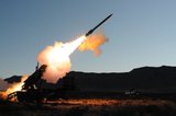
![Is the US magazine of air defence interceptors deep enough to sustain a long campaign against Iran?]()
Is the US magazine of air defence interceptors deep enough to sustain a long campaign against Iran?
The Pentagon spent a considerable number of THAAD and SM-3 rounds to defend against Iranian missiles in 2025 and has not fully replenished its reserves.
-
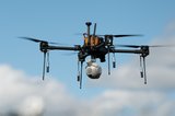
![New Zealand buys tri-service uncrewed kit from Syos Aerospace]()
New Zealand buys tri-service uncrewed kit from Syos Aerospace
As uncrewed technology continues to play an increasingly central role in modern military activities, New Zealand’s recent acquisitions point towards its the force’s focus on cost-effective capability.