
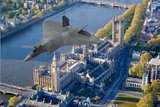
West Point map new drone course


The US Military Academy at West Point has introduced a UAV geospatial mapping module into its cadet training, which it hopes will pave the way for operations of this type by active duty personnel.
The New York-based academy purchased a Trimble UX5 UAV in 2015, after which cadets were offered the opportunity to use Esri’s Drone2Map software to incorporate UAV mapping into the geospatial intelligence module at the school.
This was beta tested in March 2016 but as of the beginning of 2017 cadets studying photogrammatry will be able to graduate in a module dedicated to UAV geospatial mapping.
‘We
Our news & analysis is now part of Defence Insight®
A Basic-level or higher Defence Insight subscription is now required to view this content.


More from Uncrewed Vehicles
-
![The shift away from Chinese drone technology presents supplier opportunities]()
The shift away from Chinese drone technology presents supplier opportunities
As countries increasingly move away from Chinese drone manufacturing and focus on domestic production and collaboration, Europe and the US are well-placed to step in – although cost remains a crucial consideration.
-
![What’s next for the Pentagon after the Replicator programme?]()
What’s next for the Pentagon after the Replicator programme?
Although the Replicator initiative has made several accomplishments, there are still multiple gaps to plug across the US Department of Defense (DoD) and its services.
-
![Cummings Aerospace showcases Hellhound loitering munition designed for US Army’s LASSO programme (video)]()
Cummings Aerospace showcases Hellhound loitering munition designed for US Army’s LASSO programme (video)
Cummings Aerospace presented its turbojet-powered Hellhound loitering munition at SOF Week 2025, offering a man-portable solution aligned with the US Army’s LASSO requirements.
-
![SOF Week 2025: PDW unveils attritable FPV drone for SOF operations at scale]()
SOF Week 2025: PDW unveils attritable FPV drone for SOF operations at scale
PDW has revealed its Attritable Multirotor First Person View drone at SOF Week 2025, offering special operations forces a low-cost, rapidly deployable platform for strike and ISR missions, inspired by battlefield lessons from Ukraine.
-
![SOF Week 2025: Teledyne FLIR white paper provides guidance on reusable loitering munitions]()
SOF Week 2025: Teledyne FLIR white paper provides guidance on reusable loitering munitions
Teledyne FLIR is highlighting the emerging requirements for 'recoverable and re-usable' loitering munitions across the contemporary operating environment during this week’s SOF Week conference in Tampa, Florida.
-
![SOF Week 2025: Kraken Technology group debuts K3 Scout USV in North America]()
SOF Week 2025: Kraken Technology group debuts K3 Scout USV in North America
High-performance maritime industry player Kraken Technology Group, based in the UK, has used the SOF Week conference in Tampa, Florida this week to debut its K3 Scout uncrewed surface vessel (USV) to the North American market.


