
DARPA launches Aerial Dragnet


The US Defense Advanced Research Projects Agency (DARPA) has launched the Aerial Dragnet programme to map small UAS in urban terrain, it was announced on 13 September.
The programme is looking for innovative technologies to provide wide-area surveillance of all UAS operating below 1,000ft in a large city. While the programme aims to protect soldiers operating in urban settings overseas, the system could ultimately find civilian application to help protect US metropolitan areas from UAS-enabled terrorist threats DARPA said.
Aerial Dragnet seeks to develop systems adapted to the fundamental physics of small UAS in urban environments that could enable non-line-of-sight (NLOS) tracking and identification of a wide range of slow, low-flying threats.
The surveillance nodes should use sensor technologies to look over and between buildings and maintain UAS tracks even when the craft disappear from sight around corners or behind objects. The programme will combine low cost sensor hardware with software-defined signal processing hosted on existing UAS platforms.
Jeff Krolik, DARPA programme manager, said: ‘Commercial websites currently exist that display in real time the tracks of relatively high and fast aircraft—from small general aviation planes to large airliners—all overlaid on geographical maps as they fly around the country and the world. We want a similar capability for identifying and tracking slower, low-flying unmanned aerial systems, particularly in urban environments.’


More from Uncrewed Vehicles
-
![The shift away from Chinese drone technology presents supplier opportunities]()
The shift away from Chinese drone technology presents supplier opportunities
As countries increasingly move away from Chinese drone manufacturing and focus on domestic production and collaboration, Europe and the US are well-placed to step in – although cost remains a crucial consideration.
-
![What’s next for the Pentagon after the Replicator programme?]()
What’s next for the Pentagon after the Replicator programme?
Although the Replicator initiative has made several accomplishments, there are still multiple gaps to plug across the US Department of Defense (DoD) and its services.
-
![Cummings Aerospace showcases Hellhound loitering munition designed for US Army’s LASSO programme (video)]()
Cummings Aerospace showcases Hellhound loitering munition designed for US Army’s LASSO programme (video)
Cummings Aerospace presented its turbojet-powered Hellhound loitering munition at SOF Week 2025, offering a man-portable solution aligned with the US Army’s LASSO requirements.
-
![SOF Week 2025: PDW unveils attritable FPV drone for SOF operations at scale]()
SOF Week 2025: PDW unveils attritable FPV drone for SOF operations at scale
PDW has revealed its Attritable Multirotor First Person View drone at SOF Week 2025, offering special operations forces a low-cost, rapidly deployable platform for strike and ISR missions, inspired by battlefield lessons from Ukraine.
-
![SOF Week 2025: Teledyne FLIR white paper provides guidance on reusable loitering munitions]()
SOF Week 2025: Teledyne FLIR white paper provides guidance on reusable loitering munitions
Teledyne FLIR is highlighting the emerging requirements for 'recoverable and re-usable' loitering munitions across the contemporary operating environment during this week’s SOF Week conference in Tampa, Florida.
-
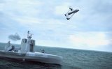
![SOF Week 2025: Kraken Technology group debuts K3 Scout USV in North America]()
SOF Week 2025: Kraken Technology group debuts K3 Scout USV in North America
High-performance maritime industry player Kraken Technology Group, based in the UK, has used the SOF Week conference in Tampa, Florida this week to debut its K3 Scout uncrewed surface vessel (USV) to the North American market.


