


I/ITSEC casts light on simulation and training trends
One of the key benefits of I/ITSEC is its ability to shine a spotlight on the current state of the military training and simulation market. …

MetaVR is set to showcase new features in its terrain and visualisation simulation technology at I/ITSEC 2017 in Oralndo.
The company will demonstrate Its Virtual Reality Scene Generator (VRSG) with new visual fidelity features including shadows cast from static culture models, screen space ambient occlusion and several enhancements to 3D ocean simulation.
Two new 3D terrain datasets will also be introduced, built in Metadesic round-earth format with the latest version of MetaVR Terrain Tools for Esri ArcGIS.
As part of I/ITSEC’s Operation Blended Warrior (OBW) MetaVR will bring high-resolution geospecific terrain dataset of California, Washington, and portions of Nevada and Arizona,
Our news & analysis is now part of Defence Insight®
A Basic-level or higher Defence Insight subscription is now required to view this content.
One of the key benefits of I/ITSEC is its ability to shine a spotlight on the current state of the military training and simulation market. …

In early November, Rheinmetall transferred the first of 35 MAN TGX series trucks to the German Armed Forces n Oldenburg for driver training. The contract is …

Meggitt Training Systems has launched its new immersive, multi-screen FATS 300 system at I/ITSEC 2017. The system is designed to provide an immersive training environment …

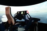
Training and simulation specialists Rockwell Collins used this year's I/ITSEC to showcase how it is moving forward with joint force solutions in the live, virtual …

The US Naval Air Systems Command (NAVAIR) is looking to leverage virtual reality technology as it develops new flight simulation trainers. The Naval Aviation Training …

The US Army Research Laboratory is pioneering studies into test dummies that accurately represent what happens to the human body when involved in a vehicle …

Connect with us on socials


