


US Navy foresees an uncrewed future for its surface and underwater fleet
The service has been conducting various procurement and development efforts to integrate unmanned surface and underwater vehicles into its inventory.

Remote GeoSystems will provide direct support in all LineVision Desktop, Server and Cloud applications for the DJI Inspire 1 UAVs for HD and UltraHD video capture, the company announced on 20 August.
The newly launched capability enables operators of the DJI Inspire 1 and other commercial UAVs to create and deliver professional-grade, interactive video survey and inspection work products using GIS and CAD software such as Google Earth, Bing Maps, PLS-CADD and Esri ArcGIS Platform.
The development means that operators of supported systems only need to enable .SRT file logging during flight video recording. LineVision will enable operators to load or upload the video and GPS track of the flight to a map once the flight is complete. A cursor moves along the uploaded GPS track as the video plays, and users can click on points on the GPS track to navigate the video recording.
LineVision also features import/upload and ‘one-click’ geo-referencing of all the rich media, such as audio, photos, PDF, CAD files and Microsoft Office files. It features flexible mapping options, which allows the operator to incorporate and ‘stream’ background maps and data layers from their enterprise GIS and third-party map service providers.
All important data types can be saved in a proprietary Remote GeoSystems file for data portability and analysis in LineVision software.


The service has been conducting various procurement and development efforts to integrate unmanned surface and underwater vehicles into its inventory.

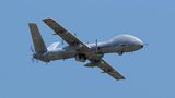
Tekever has manufactured the AR3, AR4 and AR5 UAS with all systems sharing common electronics and software architecture, which has enabled the reuse of ground segment elements within the new ARX UAS.
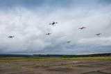
As the dynamics of aerial combat rapidly evolve, Chinese scientists have engineered a sophisticated air separation drone model that can fragment into up to six drones, each capable of executing distinct battlefield roles and challenging the efficacy of current anti-drone defences such as the UK’s Dragonfire laser system.
Advancements in air defence technologies have begun to reshape aerial combat dynamics in the Middle East, as illustrated by recent events involving the Israeli Air Force and Hezbollah.

Both sides of the Russia-Ukraine war have been using UAS for effective low-cost attacks, as well as impactful web and social media footage. Thousands more have now been committed to Ukrainian forces.
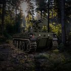
The US Army has intentions to develop light, medium and heavy variants of the Robotic Combat Vehicle (RCV) as part of the branche’s Next Generation Combat Vehicle family.

Connect with us on socials


