


What’s next for the Pentagon after the Replicator programme?
Although the Replicator initiative has made several accomplishments, there are still multiple gaps to plug across the US Department of Defense (DoD) and its services.

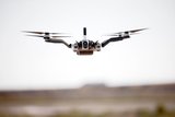
The need for disaster relief agencies to carry out unmanned aerial surveillance of affected areas has prompted a growth in requests for access to geo-referencing and mapping solutions.
In specific cases where remote assessments of a site are critical, the ability of UAS operators to make use of ‘direct geo-referencing capabilities’ is a significant advantage, according to Brad Schmidt, global sales manager at Applanix.
As a global navigation satellite system, inertial navigation system (GNSS INS) provider of geo-referencing data, the company offers positioning capabilities to UAS operators by acquiring satellite data and integrating it with orientation technology, forming the basis
Already have an account? Log in


Although the Replicator initiative has made several accomplishments, there are still multiple gaps to plug across the US Department of Defense (DoD) and its services.

Cummings Aerospace presented its turbojet-powered Hellhound loitering munition at SOF Week 2025, offering a man-portable solution aligned with the US Army’s LASSO requirements.

PDW has revealed its Attritable Multirotor First Person View drone at SOF Week 2025, offering special operations forces a low-cost, rapidly deployable platform for strike and ISR missions, inspired by battlefield lessons from Ukraine.

Teledyne FLIR is highlighting the emerging requirements for 'recoverable and re-usable' loitering munitions across the contemporary operating environment during this week’s SOF Week conference in Tampa, Florida.

High-performance maritime industry player Kraken Technology Group, based in the UK, has used the SOF Week conference in Tampa, Florida this week to debut its K3 Scout uncrewed surface vessel (USV) to the North American market.
Red Cat and Palladyne AI recently conducted a cross-platform collaborative flight involving three diverse heterogeneous drones.

Connect with us on socials


