


What’s next for the Pentagon after the Replicator programme?
Although the Replicator initiative has made several accomplishments, there are still multiple gaps to plug across the US Department of Defense (DoD) and its services.

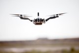
A teaming arrangement between Bluesky and Cyberhawk will target the unmanned aerial survey and mapping market, a statement from Bluesky announced on 27 January.
Bluesky is an aerial mapping company, while Cyberhawk provides unmanned airborne inspection and survey services.
The collaboration will allow Bluesky’s customers to take advantage of the rapid data collection and shorter mobilisation, acquisition and processing times associated with Cyberhawk’s UAV technology and powerful iHawk cloud software. In turn, the partnership will provide Cyberhawk clients access to the latest aerial survey sensors and equipment; including an integrated sensor for the capture of aerial photography, LiDAR and thermal data – essential for large scale data capture projects that require manned aircraft.
Rachel Tidmarsh, managing director, Bluesky International, said: ‘We are often asked if we can capture a specific location or industrial installation, either at short notice or on a specific date and time. By partnering with Cyberhawk, we can be confident that our customers will receive the high standards of customer service and product quality they have come to expect.’
Phil Buchan, commercial director, Cyberhawk Innovations, added: ‘The partnership with Bluesky will allow us to complement our existing UAV offering with nationwide coverage of aerial photography and 3D height data, as well as more specialist capture and production including thermal surveys, LiDAR and even air quality monitoring and night time surveys.’


Although the Replicator initiative has made several accomplishments, there are still multiple gaps to plug across the US Department of Defense (DoD) and its services.

Cummings Aerospace presented its turbojet-powered Hellhound loitering munition at SOF Week 2025, offering a man-portable solution aligned with the US Army’s LASSO requirements.

PDW has revealed its Attritable Multirotor First Person View drone at SOF Week 2025, offering special operations forces a low-cost, rapidly deployable platform for strike and ISR missions, inspired by battlefield lessons from Ukraine.

Teledyne FLIR is highlighting the emerging requirements for 'recoverable and re-usable' loitering munitions across the contemporary operating environment during this week’s SOF Week conference in Tampa, Florida.

High-performance maritime industry player Kraken Technology Group, based in the UK, has used the SOF Week conference in Tampa, Florida this week to debut its K3 Scout uncrewed surface vessel (USV) to the North American market.
Red Cat and Palladyne AI recently conducted a cross-platform collaborative flight involving three diverse heterogeneous drones.

Connect with us on socials


