UAV Vision expands Camera Gimbals range
UAV Vision has released the latest in their growing range of low cost, light weight Camera Gimbals. The new addition to the product line is the CM160 High Resolution Stills Gimbal, suitable for a vast number of applications including, but not limited to:
* Mapping
* Infrastructure inspection (from air ground or sea)
* Precision surveillance tasks, e.g. narcotics eradication and other law enforcement applications
The Gimbal provides 16 megapixel still images at up to 3 frames per second through a GigE / ethernet interface, while also streaming EO video. This provides a user with the ability to manoeuvre the Gimbal and record video imagery, while collecting high resolution still snapshots for the application at hand.
All these features are housed in the trusted CM160 gimbal and boasts all the typical features of this proven UAV Vision gimbal - IP66 (water and dust proof), no ITAR/export restrictions, lightweight, low cost, gyro stabilised - view all features here.
The Gimbal is suitable for a range of applications, on almost any platform. The CM160 Gimbal is currently deployed on many platforms, including UAVs (rotary and fixed wing), manned aircraft (fixed wing, gyrocopters/gyroplanes, helicopters), and marine surface vessels. Current testing is being undertaken on ground vehicle platforms.
We are developing advanced features into our AI System software to allow automatic high resolution still snapshots to be taken. This will be of huge benefit to mapping, surveillance, narcotics, and law enforcement type applications where large areas are required to be captured with high resolution imagery. The system will automatically capture overlapping GEO-REFERENCED images for later analysis.
The operator is able to see exactly where images have been captured via overlays, with options to toggle them on or off in relation a moving map displaying a matching position. The user also has the ability to navigate through, and interact with (pan, zoom etc), previously captured images to see if the required objects of interest have been captured successfully.
Source: UAV Vision


More from Uncrewed Vehicles
-
![Ready for the race: Air separation drone swarms vs. air defence systems]()
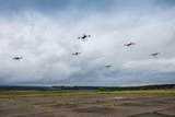
Ready for the race: Air separation drone swarms vs. air defence systems
As the dynamics of aerial combat rapidly evolve, Chinese scientists have engineered a sophisticated air separation drone model that can fragment into up to six drones, each capable of executing distinct battlefield roles and challenging the efficacy of current anti-drone defences such as the UK’s Dragonfire laser system.
-
![Israel’s MALE UAVs ‘must adapt’ to Iranian-made air defences]()
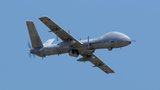
Israel’s MALE UAVs ‘must adapt’ to Iranian-made air defences
Advancements in air defence technologies have begun to reshape aerial combat dynamics in the Middle East, as illustrated by recent events involving the Israeli Air Force and Hezbollah.
-
![Hundreds more UAS sent to Ukraine forces with thousands more on the way]()
Hundreds more UAS sent to Ukraine forces with thousands more on the way
Both sides of the Russia-Ukraine war have been using UAS for effective low-cost attacks, as well as impactful web and social media footage. Thousands more have now been committed to Ukrainian forces.
-
![AI and software companies selected for US Army Robotic Combat Vehicle subsystems]()
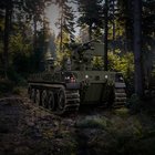
AI and software companies selected for US Army Robotic Combat Vehicle subsystems
The US Army has intentions to develop light, medium and heavy variants of the Robotic Combat Vehicle (RCV) as part of the branche’s Next Generation Combat Vehicle family.
-
![DroneShield to improve software of DroneSentry-X C-UAS system under new contract]()
DroneShield to improve software of DroneSentry-X C-UAS system under new contract
DroneSentry-X, a cross-vehicle compatible, automated 360° C-UAS detect and defeat device, can offer 360° awareness and protection using integrated sensors. According to its manufacturer, it is suitable for mobile operations, on-site surveillance and on-the-move missions.
-
![Ukraine takes delivery of new indigenous C-UAS systems]()
Ukraine takes delivery of new indigenous C-UAS systems
Funded by the country’s former president, the new C-UAS systems will be sent to the frontline where they have already been tested against Russian invading forces.