


US Navy foresees an uncrewed future for its surface and underwater fleet
The service has been conducting various procurement and development efforts to integrate unmanned surface and underwater vehicles into its inventory.

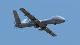
The US version of the AirMap digital map and airspace database for Unmanned Aircraft System (UAS) operators has launched, giving UAS operators a clearer understanding of where they can fly their systems.
The map includes areas where UAS may not be permitted to fly and provides low-altitude airspace information needed by UAS operators. It was co-founded by entrepreneur Ben Marcus and Gregory McNeal, a legal scholar on UAS, public policy and air rights.
AirMap integrates multiple data sources and gives detailed information to UAS operators, with a single view of the restricted areas around an area of operations. The beta-version of the site is now live in the US and launching internationally shortly.
AirMap only shows the airspace rules that impact UAS operators and focuses on airspace information from ground level up to 500ft. Operators will be able to customise their display based on their operation type and select layers depicting recreational use airspace, blanket COA rules and controlled airspace (Class B, C, D, and E) at 500ft and below.
Marcus said: 'As UAS use continues to expand, the airspace in which operators are flying is also growing more complex. With this in mind, we've launched AirMap, which will serve as a resource for drone operators to immediately fly safely and in compliance with legal requirements. We want to make safe flying easy.'
McNeal said: 'As a drone operator I found it hard to know what the airspace rules were in the places where I wanted to fly. There were no accurate visuals or reliable electronic tools that could tell me and other operators where we can and cannot fly. AirMap solves this problem and helps to educate operators about this complex regulatory environment.
'The demand for AirMap is clear, as it is the most thorough resource for drone operators to ensure safe, legal and hassle-free flight.'


The service has been conducting various procurement and development efforts to integrate unmanned surface and underwater vehicles into its inventory.

Tekever has manufactured the AR3, AR4 and AR5 UAS with all systems sharing common electronics and software architecture, which has enabled the reuse of ground segment elements within the new ARX UAS.
As the dynamics of aerial combat rapidly evolve, Chinese scientists have engineered a sophisticated air separation drone model that can fragment into up to six drones, each capable of executing distinct battlefield roles and challenging the efficacy of current anti-drone defences such as the UK’s Dragonfire laser system.
Advancements in air defence technologies have begun to reshape aerial combat dynamics in the Middle East, as illustrated by recent events involving the Israeli Air Force and Hezbollah.

Both sides of the Russia-Ukraine war have been using UAS for effective low-cost attacks, as well as impactful web and social media footage. Thousands more have now been committed to Ukrainian forces.
The US Army has intentions to develop light, medium and heavy variants of the Robotic Combat Vehicle (RCV) as part of the branche’s Next Generation Combat Vehicle family.

Connect with us on socials


